Hydra Project: Precision Mapping of FTL & Buffer Zones
2024
Industry
GIS
Challenge
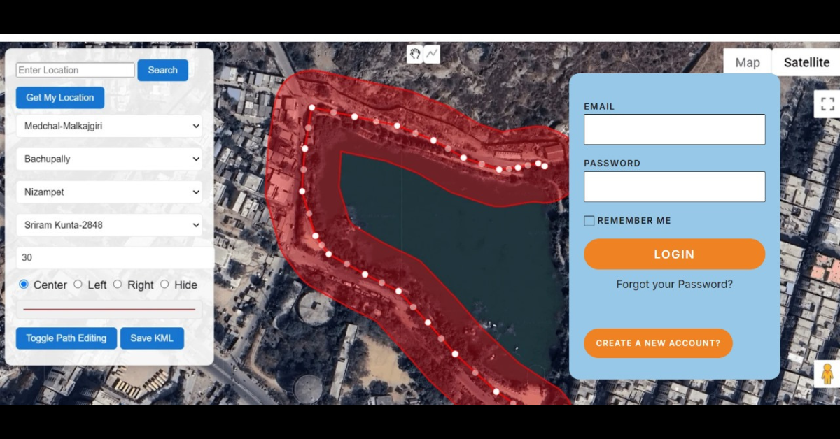
Defining Full Tank Level (FTL) and buffer zones accurately was crucial for environmental conservation, urban planning, and regulatory compliance. Traditional mapping methods were inefficient, often relying on outdated or inconsistent data, leading to inaccuracies in boundary delineation and potential legal disputes. A robust, automated solution was needed to ensure precise mapping and real-time updates.
Solution
Developed an advanced GIS-based mapping system to accurately define FTL and buffer zones using satellite imagery, survey data, and topographical analysis. The system integrates spatial data processing techniques to detect water body extents dynamically, ensuring compliance with legal regulations and environmental guidelines. Additionally, an interactive dashboard provides real-time updates, overlays historical data, and enables authorities to monitor encroachments effectively. By automating the mapping process, the Hydra Project enhances decision-making, improves regulatory enforcement, and supports sustainable water resource management.


Need help with similar project?
I can recommend the best solution that suits the needs of your organization in required time frame.
Get in touch with me for more details & get your problem solved via technology.